
The image below is an overlay of a SAR intensity image recorded by the APL-UW dual-beam along-track interferometric microASAR system (the microASAR units are developed by Artemis, Inc., http://artemisinc.net). This data was recorded on May 2 at 11:55 EDT during the low tide. A Google Earth version of this image (KMZ file) can be downloaded from http://herschel.apl.washington.edu/darla/RADAR/SAR/SNAPSHOTS/uASAR_05022012_115500CH1_image532376_-9.kmz.
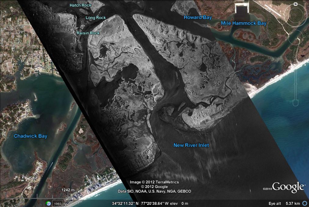 The width of the image is around 3 km. Breaking waves around the inlet are not focused correctly by the SAR processing code because their Doppler shift is non-zero. However, the regions in which active breaking is clear. Patches of increased surface roughness, possibly due to lines of convergence, and also slicks are evident in the inlet and river.
We will be using this data to form interferograms from which we will estimate surface velocity.