
Yesterday (May 2nd) we deployed two quadpods in the old and new channel (near the outer most red can channel marker #4) at the locations in the linked kml These are 7′ tall frames that have the upper ~2 exposed at low tide and are submerged by ~2′ at high tide. They have various downward aimed sensors to measure flow, … Read More
Radar snap of waves
This is an example radar image showing crossing wave trains on the shoal that extends from the south side of the inlet. We are analyzing these image sequences to see how well (or not) wave directions can be extracted and bathymetry estimated. Hope to have more soon.
Merge Images available
I’m not sure if this is well known yet, but Argus merged images are available on the web at http://cil-www.oce.orst.edu/RIVETmerge. They are posted as they are collected and consist of snap, timex, var, bright and dark images for every 1/2 hour. The upper half of the page is rectifications for the large inlet area at 2.5 m resolution. If you … Read More

Day 2 of drifter releases
Today was day 2 of drifter releases. Everything went very well with the exception of possibly dinging the WHOI location 55 with our Whaler. We did three releases. The first was during a strong ebb tide. The 2nd was an attempt to capture the transition from ebb to flood. Two drifter track images are shown below. The first image is … Read More
First day of drifter releases. Ebb and Flood
Today was the first day of the SIO (Feddersen/Guza) drifter releases. We did 3 set of 2hr+ drifter releases with our 35 drifter fleet. The first release began at about 0830 as the tide began to ebb. We released the 35 drifters near channel marker 08 but in slightly different cross-channel positions – see the screenshot image below … Read More
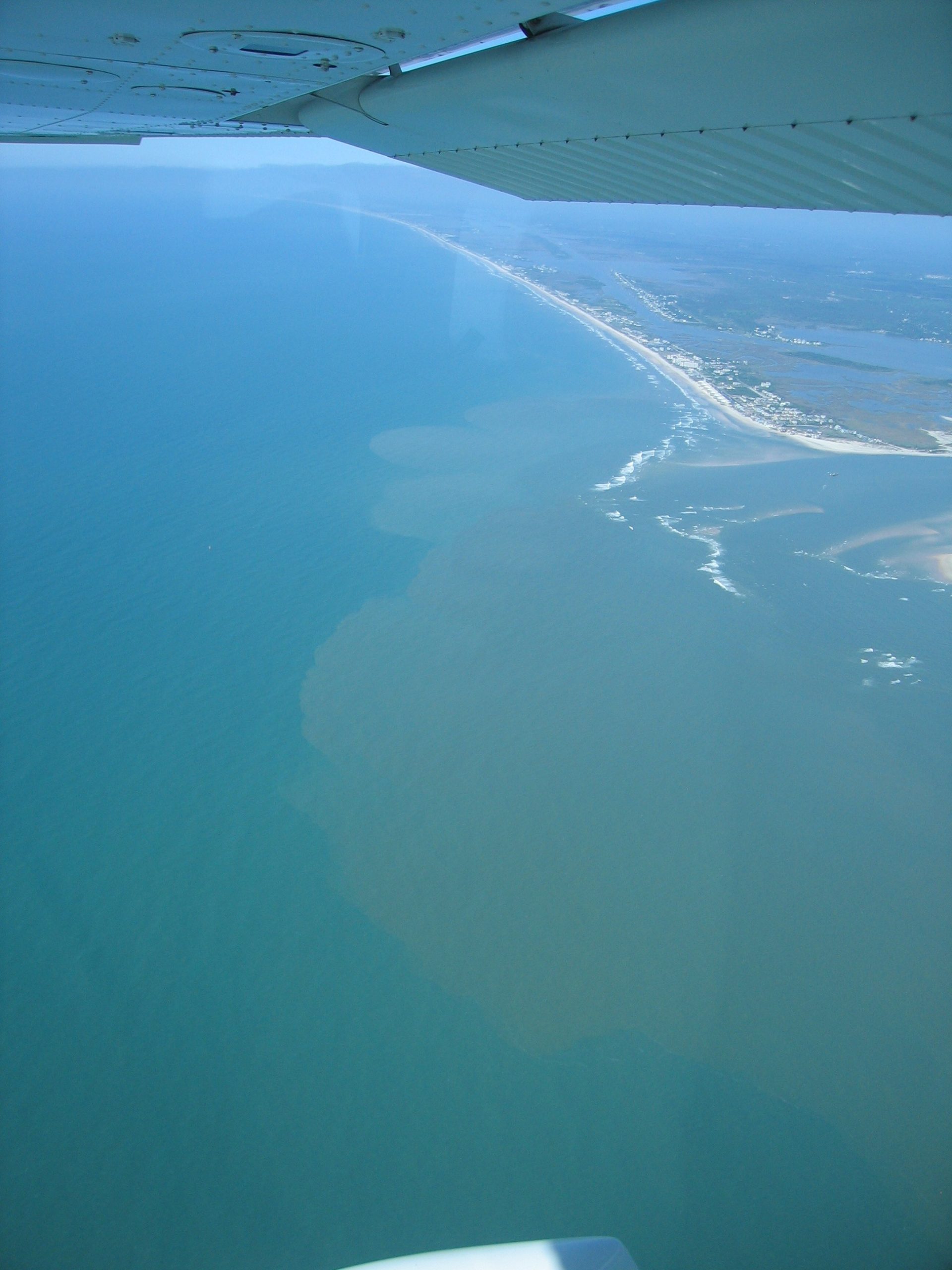
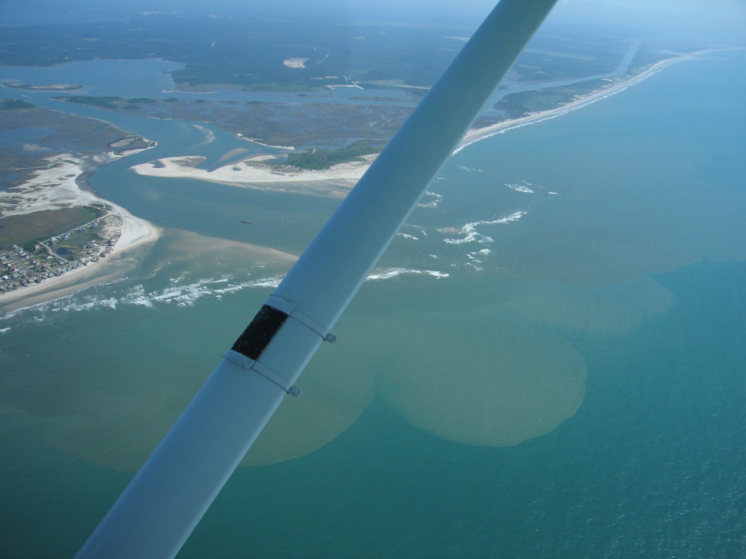
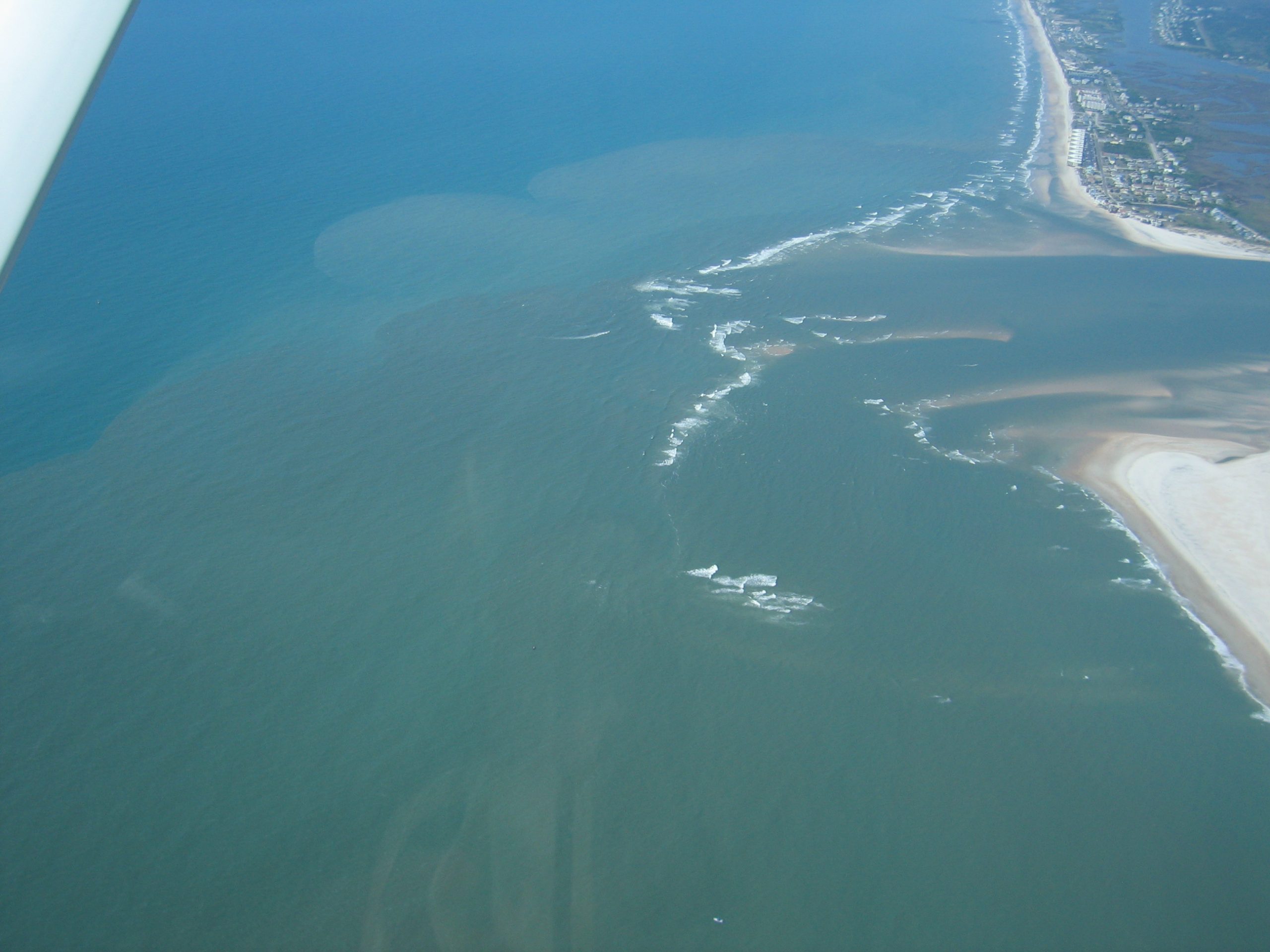
RIVET from the air
Airborne operations are underway at RIVET. Below are some photographs of the inlet from the APL-UW test flight on Monday (17:00 – 18:00 local time). Onboard the Cessna 172, we have a dual-beam along-track interferometric synthetic aperture radar, two infrared cameras, and a visible wavelength camera. We will be posting imagery from these sensors as soon as it is available.
Sidescan Imagery
In preparation for our quadpod deployement I conducted a quick sidescan survey of the old channel out my pod1 site and the new channel out to my pod2 site. Here is one spot in the newly dredged channel near WHOI (Elgar&Raubenhiemer’s) site 07. KMZ’s with the complete data set can be downloaded here: https://docs.google.com/open?id=0B-O7NMkrpqL6MS1mYy1xY0lGRU0 Follow the links to pre-deployement survey. … Read More
Example Merged Rectifications
Here are example merged Argus products that we will be putting on the web. If you have suggestions for changes, let us know. For example, we will add instrument locations as we learn them. The first is a large area time exposure showing the shoal configuration. The second in a small area snap that shows fierce crossing wave patterns.
Delft3D model simulations posted
From Ad Reneirs & Patrick Rynne: All, We’ve posted the latest model predictions for NRI for the 28th-29th at the link below. Please click on the .zip file link in the center of the page. http://newriverinlet.com/Model_-_Results.html we are driving up today, predictions will be more timely in the days ahead once we get settled. cheers! -Patrick & Ad Below is … Read More