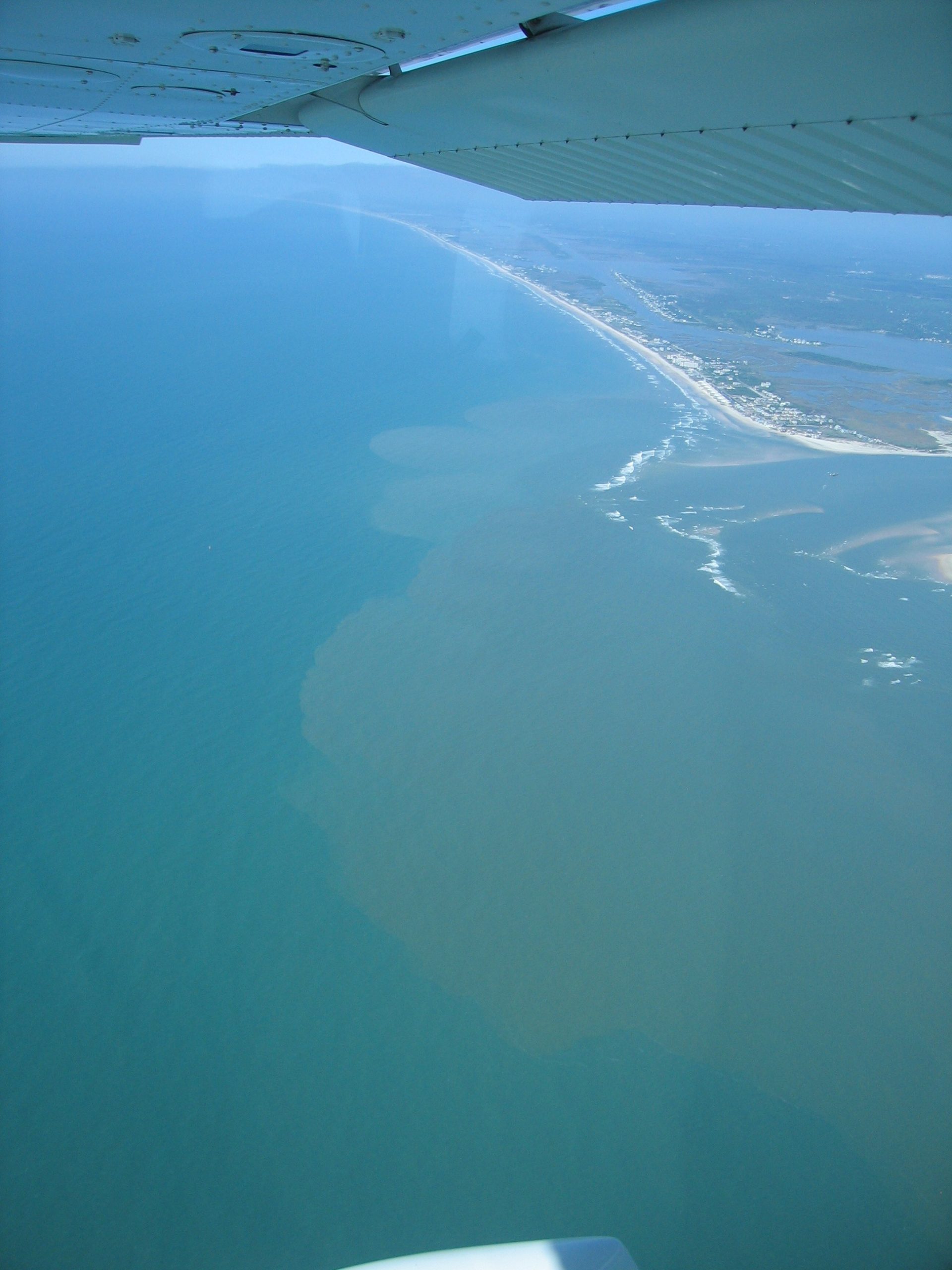
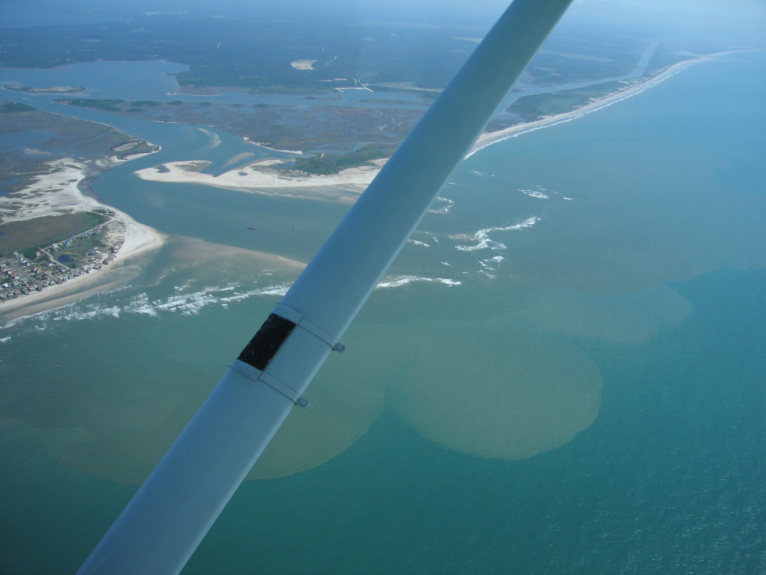
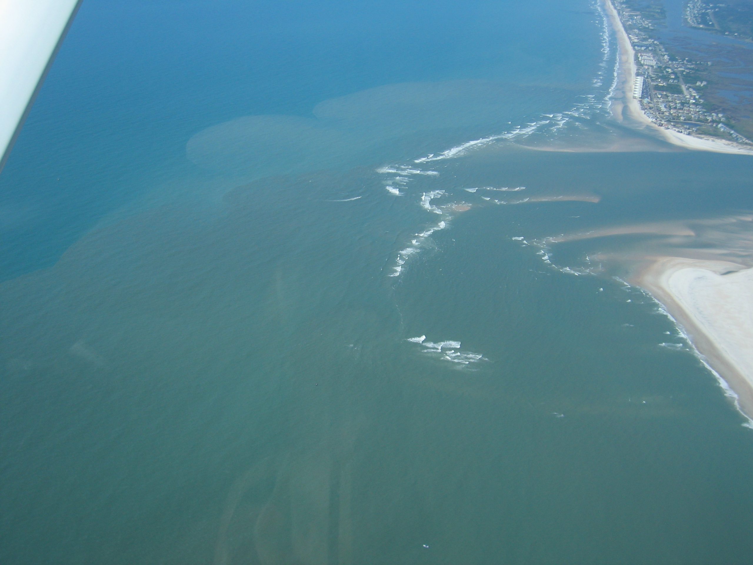
First ever blog post for me. The ‘other’ Scripps group has been running the REMUS AUV to characterize inlet dynamics and map the outgoing plume. Before the dye surveys, we ran a series of missions to survey the naturally occuring optical signals leaving the inlet over an outgoing tide. Above are cross-sections of CDOM across 4 different transects. We’ve also … Read More
Yesterday (May 6th) was the First Day of Dye Releases
Yesterday (May 6th) was the first day of dye releases. Although we had a couple of glitches things overall went very smooth. In the AM we deployed 15 fluorometers (measure dye concentration) at the SIO and WHOI current meter locations. Combined with the velocity measurements, this allows one to make flux measurements of dye out or into the inlet. The … Read More
NRL ATI-SAR Imagery of the New River Inlet
After arriving on Monday, our NRL SAR crew flew on Tuesday, Wednesday, and Friday of this week. Apart from some drama before the first flight (resolved with a 300-foot daisy chain of extension cords across the airport tarmac), we’ve had no major hardware issues and have enjoyed excellent SAR collection conditions: decent surface winds to roughen the water, but smooth flying at 2900′. Smooth … Read More
West Side Bedforms
Attached is a higher resolution local merged timex from today’s low tide showing detailed bedforms on the western side of the inlet. I’m amazed by the amount of structure. Also, we have posted a first draft web description of Argus at RIVET at cil-www.oce.orst.edu/rivet. It includes description of our geometry set up procedure and the location of a decent 3D … Read More
APL-UW SAR imagery of the New River Inlet
The image below is an overlay of a SAR intensity image recorded by the APL-UW dual-beam along-track interferometric microASAR system (the microASAR units are developed by Artemis, Inc., http://artemisinc.net). This data was recorded on May 2 at 11:55 EDT during the low tide. A Google Earth version of this image (KMZ file) can be downloaded from http://herschel.apl.washington.edu/darla/RADAR/SAR/SNAPSHOTS/uASAR_05022012_115500CH1_image532376_-9.kmz. The width of … Read More
Day 3 of Drifter Releases
Yesterday (May 3rd) was the 3rd day of SIO drifter releases. It was quite interesting. We released again on an ebb tide near channel marker 8. This time we released drifters in pairs (except for the last 3) separated by 1 minute. With 33 drifters it took 17 minutes. The reason for time separation was to see how that might … Read More
Traykovski WHOI Quadpod deployment
Yesterday (May 2nd) we deployed two quadpods in the old and new channel (near the outer most red can channel marker #4) at the locations in the linked kml These are 7′ tall frames that have the upper ~2 exposed at low tide and are submerged by ~2′ at high tide. They have various downward aimed sensors to measure flow, … Read More
Radar snap of waves
This is an example radar image showing crossing wave trains on the shoal that extends from the south side of the inlet. We are analyzing these image sequences to see how well (or not) wave directions can be extracted and bathymetry estimated. Hope to have more soon.
Merge Images available
I’m not sure if this is well known yet, but Argus merged images are available on the web at http://cil-www.oce.orst.edu/RIVETmerge. They are posted as they are collected and consist of snap, timex, var, bright and dark images for every 1/2 hour. The upper half of the page is rectifications for the large inlet area at 2.5 m resolution. If you … Read More